Weather Radar by WeatherBug
Weather
Live Weather Radar Alerts Forecasts For Everyone
App Screenshots


About Weather Radar by WeatherBug Feature
Weather Radar by WeatherBug is a professional-grade weather application dedicated to providing users with precise, real-time, and hyper-local weather information. It stands out in the crowded field of weather apps by integrating advanced radar technology, a vast network of personal weather stations, and severe weather alerts. The app delivers not just forecasts but a comprehensive situational awareness tool for weather conditions, helping users make informed decisions whether planning daily activities or preparing for significant weather events. Its core mission is to keep users safe, informed, and ahead of the weather through reliable data and intuitive visualization.
Chapter 1: Function
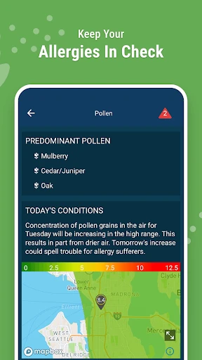
Weather Radar by WeatherBug excels in delivering detailed meteorological data through several core functions. Its centerpiece is an interactive, high-resolution radar map that provides real-time precipitation tracking, allowing users to zoom in on their exact location and view storm movement with futurecast loops. The app offers precise, street-level current conditions and forecasts powered by its proprietary Spark lightning detection network and data from over 250,000 personal weather stations worldwide. Users can set customizable severe weather alerts for lightning, hail, tornadoes, and floods. Additional features include detailed hourly and 10-day forecasts, pollen and air quality indices, and live camera views from thousands of locations to see actual conditions.
Chapter 2: Value
The primary value proposition of Weather Radar by WeatherBug lies in its accuracy, timeliness, and focus on safety. Unlike many basic weather services, it leverages a unique, dense data source—its global network of personal weather stations and professional sensors—to provide hyper-local conditions that standard forecasts often miss. This granularity is crucial for precise planning. Its most significant advantage is proactive safety; the app's severe weather alerts are renowned for their speed and reliability, often providing critical lead time before official warnings. The professional-grade radar visualization offers clarity and detail that appeals to both weather enthusiasts and general users seeking trustworthy information. The interface presents complex data in an accessible, user-friendly manner, balancing depth with simplicity. Furthermore, the absence of intrusive ads in key areas ensures an uninterrupted experience during critical weather monitoring. This combination of robust data infrastructure, safety-centric design, and clear presentation establishes Weather Radar by WeatherBug as a tool not just for convenience, but for preparedness and informed decision-making in an increasingly volatile climate.
Chapter 3: Scenarios
Weather Radar by WeatherBug serves a diverse range of user groups across everyday and critical situations. Primary users include outdoor professionals and enthusiasts, such as construction supervisors, event planners, farmers, and golfers, who rely on precise, minute-by-minute weather changes to schedule work and activities. Parents and school administrators use it to monitor conditions for recess, commutes, and school closures due to lightning or storms. Frequent travelers benefit from its detailed maps and alerts for multiple saved locations, ensuring they are prepared anywhere. It is indispensable for residents in areas prone to severe weather, like tornado alleys or hurricane coasts, providing vital early warning for taking shelter. In daily life, commuters check it for rain start/stop times, individuals with allergies monitor pollen counts, and families planning weekends consult its detailed hourly forecasts. Essentially, anyone needing more reliability than a simple temperature glance—prioritizing safety, precision, and planning—finds substantial value in this application.
Key Pros
- real-time animated radar with storm tracking paths
- lightning detector alerts with precise distance mapping
- hyper-local forecasts using proprietary Total Lightning Network
- offline access to saved radar maps and storm data
- integrates traffic cams for visual weather verification
Things to Note
- heavy data usage for high-resolution radar animations
- requires location always-on for precise lightning alerts
- interface feels cluttered with ads in free version
- proprietary network limits accuracy outside north america
- battery drain from constant background GPS updates
Frequently Asked Questions
Q: What is Weather Radar by WeatherBug and what does it do?
A: Weather Radar by WeatherBug is a specialized weather app focused on providing real-time, hyper-local radar maps, severe weather alerts, and forecasts. Its core function is visualizing precipitation, storm tracks, and lightning strikes on interactive animated maps. It positions itself as a tool for proactive weather monitoring, especially for planning around rain, snow, or severe storms, using professional-grade radar data.
Q: Is Weather Radar by WeatherBug free to use with in-app purchases?
A: The app is free to download and use with access to basic radar, local forecasts, and severe weather alerts. It is supported by ads. A premium subscription called 'WeatherBug Plus' is available via in-app purchase. This subscription removes ads and unlocks additional features like advanced radar layers, future radar projections, and more detailed lightning data. The specific pricing is listed within the app's store page.
Q: What devices and operating systems does this app support?
A: Weather Radar by WeatherBug is primarily designed for mobile devices. It is available for both iOS (iPhone/iPad) and Android smartphones and tablets. The app adapts its interface for different screen sizes. It relies on GPS for precise location services and requires an active internet connection (cellular or Wi-Fi) to download the latest radar data and forecasts. There is no dedicated version for desktop computers or smartwatches.
Q: How accurate and detailed is the radar map feature?
A: The app provides professional-grade radar imagery sourced from various networks, including the U.S. National Weather Service's NEXRAD. It offers high-resolution, animated maps that show precipitation type (rain, snow, mix), intensity, and storm cell movement. A core technical feature is the 'Future Radar' projection (often a premium feature), which forecasts precipitation movement up to two hours ahead. Accuracy is dependent on the underlying data sources and local terrain.
Q: Does the app send alerts for severe weather in my area?
A: Yes, a key feature of WeatherBug is its 'Spark' lightning alert system and severe weather warnings. The app can send push notifications for lightning strikes within a specified distance of your saved location, as well as for official government-issued alerts like tornado, thunderstorm, and flood warnings. Alert reliability depends on your device's notification settings and network connectivity. Users can customize alert types and distances in the app's settings.