My Earthquake Alerts - Map
Weather
Earthquake Alerts And Maps For Global Safety Awareness
App Screenshots


About My Earthquake Alerts - Map Feature
My Earthquake Alerts - Map is a specialized mobile application designed to provide real-time seismic information and early warnings. It serves as a personal safety tool, aggregating data from global and regional seismic networks to deliver instant notifications about earthquake occurrences directly to users' devices. The app's central feature is an interactive map that visually displays recent earthquake epicenters, magnitudes, and depths, allowing users to grasp seismic activity in their region or worldwide at a glance. By combining timely alerts with detailed geological data, it aims to empower individuals with the knowledge needed to react promptly and make informed decisions during seismic events, enhancing personal and community preparedness.
Chapter 1: Function
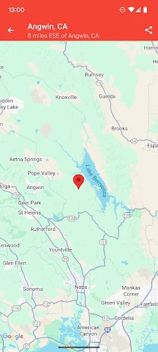
The core functionality of My Earthquake Alerts - Map revolves around real-time monitoring and notification. The app continuously fetches data from authoritative seismic sources, plotting earthquake events on an interactive global map. Users can customize alert thresholds based on magnitude and proximity, ensuring they receive push notifications only for relevant quakes. Detailed event pages provide information such as exact location coordinates, depth, time of occurrence, and estimated felt reports. Additional features include the ability to view historical earthquake data, set multiple monitored locations, and access basic safety guidelines. The map interface allows for filtering by magnitude range and time period, offering both a broad overview and detailed inspection of seismic activity.
Chapter 2: Value
The primary value proposition of My Earthquake Alerts - Map lies in its ability to transform complex seismic data into actionable, personalized safety information. Its key advantage is immediacy; by delivering alerts within seconds of an earthquake's detection, it can provide crucial seconds or minutes of warning before tremors arrive, depending on the user's distance from the epicenter. This can be vital for taking protective actions. Furthermore, the app demystifies seismic activity by presenting data visually and intuitively, fostering greater public awareness and understanding of earthquake patterns. Unlike generic news sources, it offers customization, allowing users to tailor alerts to their specific location and sensitivity, reducing alarm fatigue. The aggregation of global data into a single, reliable platform saves users from consulting multiple sources. By promoting situational awareness, the app not only aids in immediate response but also contributes to long-term preparedness planning for individuals, families, and even small businesses. Its value extends beyond mere notification, serving as an educational tool and a constant companion for those living in or traveling to seismically active regions.
Chapter 3: Scenarios
The app primarily targets individuals residing in or frequently visiting earthquake-prone areas, such as residents along the Pacific Ring of Fire, including parts of Japan, Indonesia, the western United States, and Chile. It is equally valuable for travelers exploring these regions, providing them with localized risk awareness. Daily use involves the app running quietly in the background, sending a push notification with audible alert when a significant quake occurs. A user might check the map after feeling a tremor to confirm its magnitude and epicenter. Families use it to ensure all members are notified simultaneously, facilitating quick coordination. Professionals like journalists, researchers, and emergency responders utilize it for initial event assessment. In everyday scenarios, a person working in a high-rise office receives an alert for a distant but strong quake, giving them time to move to a safer location. A parent at home uses the historical data feature to understand local seismic history. Ultimately, the app integrates into the user's daily life as a discreet yet powerful layer of environmental awareness and safety.
Key Pros
- delivers real-time alerts via push notifications even when closed
- overlays seismic data on an interactive
- zoomable global map
- provides detailed technical parameters for each seismic event
- offers customizable filters for magnitude and proximity alerts
- functions fully offline with downloadable map regions
Things to Note
- map interface can feel cluttered during high global seismic activity
- detailed technical data may overwhelm casual users seeking simple alerts
- background location use for proximity alerts impacts battery life
- requires manual region downloads for optimal offline functionality
- lacks integrated preparedness guides or safety instructions post-alert
Frequently Asked Questions
Q: What is My Earthquake Alerts - Map?
A: My Earthquake Alerts - Map is a mobile application focused on real-time seismic monitoring and early warning. Its core function is to provide users with instant notifications about earthquake occurrences worldwide, displayed on an interactive map. The app positions itself as a practical tool for situational awareness, offering basic information like magnitude, location, and depth. It does not replace official emergency alert systems but serves as a supplementary information source.
Q: Is the app free to use, and are there in-app purchases?
A: The app's alerts are based on data from various seismic networks. There is an inherent delay as data is collected and processed, so notifications are not instantaneous. The accuracy of the location and magnitude is dependent on the source data providers. This app is an informational tool and should not be solely relied upon for life-saving actions. Always follow instructions from local official emergency authorities during an actual seismic event.
Q: What should I do if the app's notifications are delayed or not working?
A: The app is free to download and use for basic real-time alerts and map viewing. It may offer optional in-app purchases, such as removing advertisements or accessing advanced features like historical data filters or more detailed seismic reports. No additional physical equipment is required. The app primarily relies on location permissions to provide relevant regional alerts and may require internet access for data synchronization.
Q: On which devices and operating systems does the app work?
A: My Earthquake Alerts - Map is designed for mobile devices. It is typically available for both Android and iOS operating systems. Specific version requirements can be found on the respective app store pages (Google Play Store or Apple App Store). The app is generally suitable for a wide user group seeking earthquake information, but its interface and data complexity may vary by device and system version.
Q: How accurate and timely are the earthquake alerts?
A: First, ensure your device's internet connection is stable and that the app has necessary permissions enabled, including background data refresh and notifications. Check the app's settings to confirm alert preferences are correctly configured. If issues persist, try restarting the app or your device. For persistent technical problems, you can seek support through the developer's contact channel provided in the app store listing. The developer does not provide emergency response services.